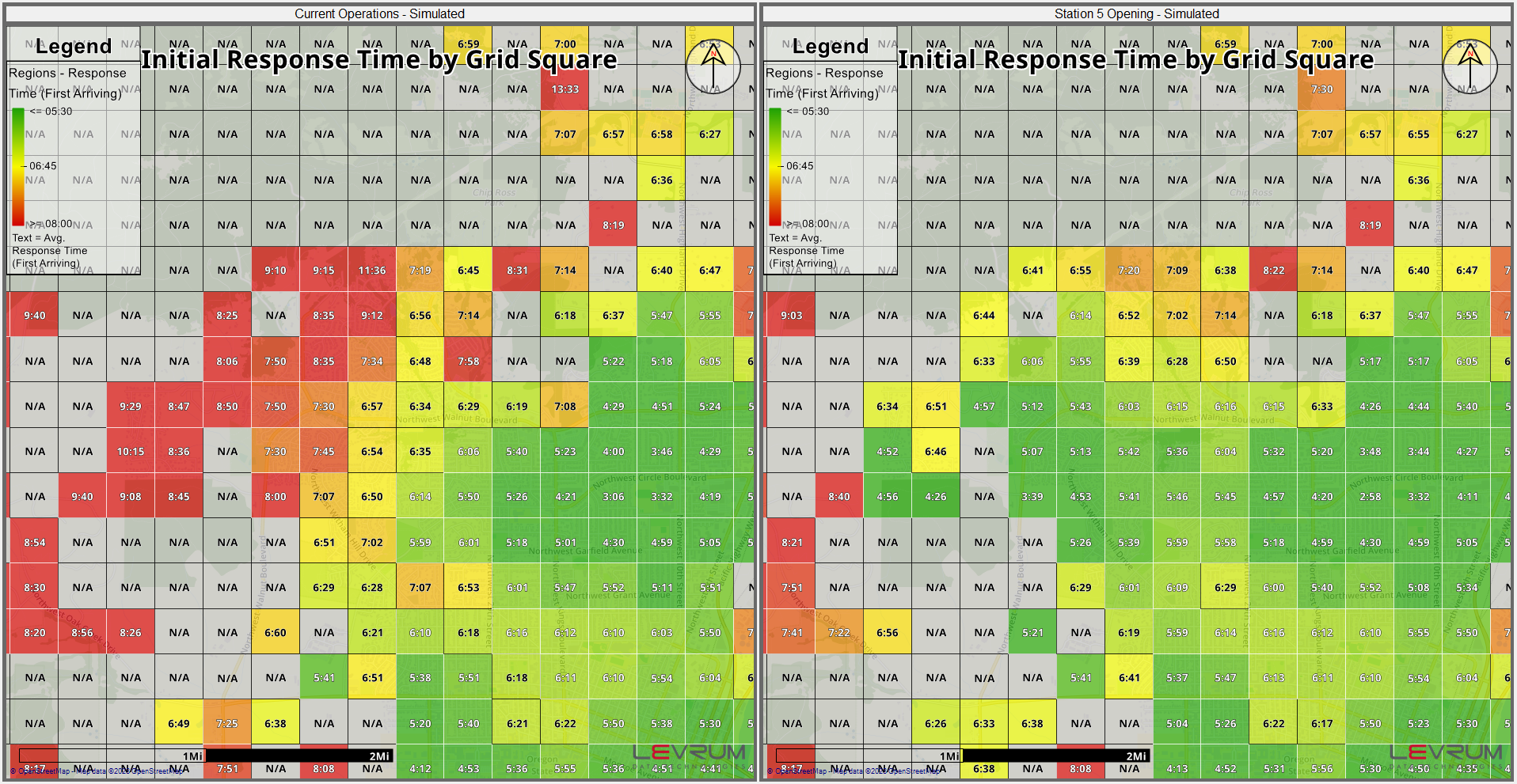
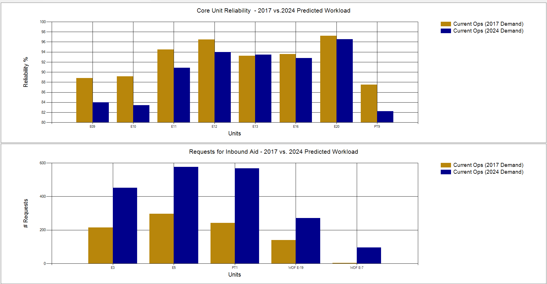
Plan for the extra demand developments will bring.
Stress test your department to find areas to work on.
Other Features
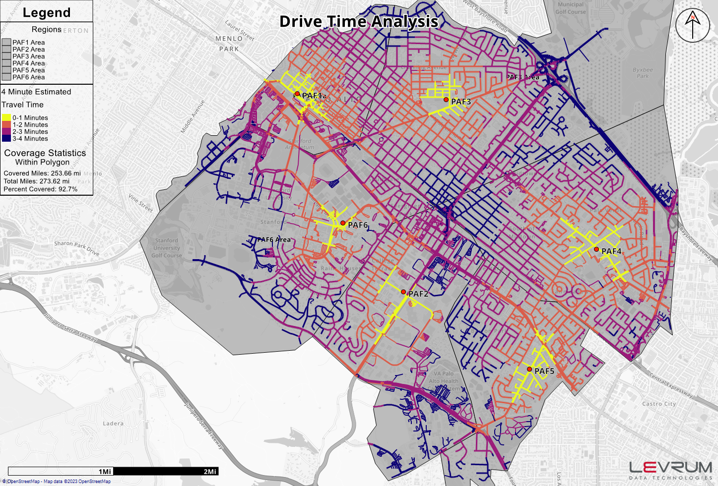
Manage multiple OSM routing files in-app with the ability to cut roads enabling the testing of road closures.
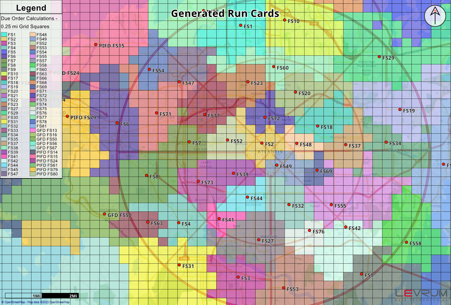
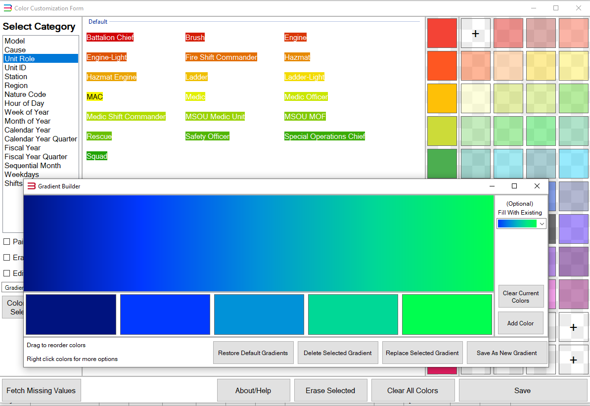
Colors can now be customized for objects across the application for charts and maps. Additionally, 13 new gradients are now built in on top of a tool that allows custom gradients to be made.
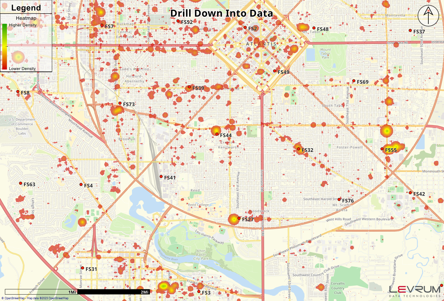
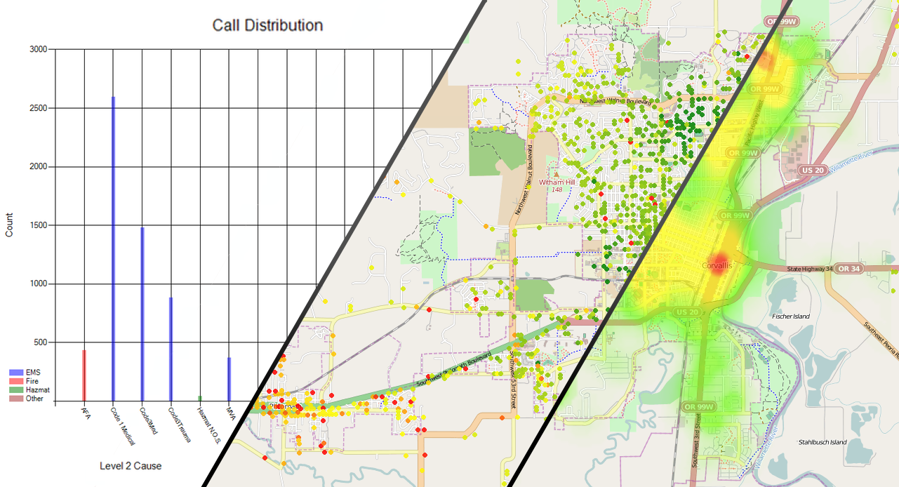
The in-app charting has received a facelift.
Performance has been improved in a number of areas leading to faster calculations and more responsive controls.